Arizona's definitive 250-mile desert-to-alpine odyssey
Other trail races within 58 miles


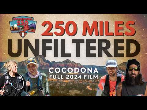
The Cocodona 250 is a 252.9-mile point-to-point journey from the Sonoran Desert of Black Canyon City to downtown Flagstaff, traversing the Black Canyon National Recreation Trail, Prescott Circle Trail, and the Arizona Trail over 5–6 days. Runners pass through the historic towns of Crown King, Prescott's Whiskey Row, Jerome, Clarkdale, and Sedona, climbing from 1,996 feet in the desert to 9,241 feet in the mountains. With 21 fully stocked aid stations offering hot meals and 4 water drops, this is the most diverse 200-mile footrace in America — a genuine tour of Arizona's full geographic character from saguaro cactus to Ponderosa pine.
Recommended for seasoned ultrarunners
Black Canyon City, AZ, United StatesMay 02, 2027
Cocodona 250 is a point-to-point trail race in Black Canyon City, AZ, United States, held on May 02, 2027. The course covers 252.9 miles, climbs 38,940 ft, and has a 125h cutoff.

Moderate trail conditions with some technical sections
| Location | Mile | Elevation | Cutoff | Crew | Pacers | Drop bags |
|---|---|---|---|---|---|---|
Deep Canyon Ranch Start | 0.0 | 1,988 ft | — | Crew | Drop Bags | |
Cottonwood Creek Aid Station | 7.4 | 2,077 ft | 4h50m9:50 AM | |||
Water Station Aid Station | 10.4 | 2,208 ft | — | |||
Water Station Aid Station | 24.6 | 2,208 ft | — | |||
Lane Mountain Aid Station | 32.5 | 6,736 ft | 17h45m10:45 PM | |||
Crown King Aid Station | 36.6 | 5,778 ft | 18h55m11:55 PM | CrewMetered Access | Drop Bags | |
Arrastra Creek Aid Station | 51.0 | 5,243 ft | 26h7:00 AM +1 | |||
Kamp Kipa Aid Station | 60.8 | 7,480 ft | 33h2:00 PM +1 | Drop Bags | ||
Camp Wamatochick Aid Station | 67.4 | 6,411 ft | 35h45m4:45 PM +1 | Drop Bags | ||
Whiskey Row Aid Station | 75.6 | 5,351 ft | 41h10:00 PM +1 | Crew | Pacers | Drop Bags |
Watson Lake Aid Station | 82.8 | 5,246 ft | 46h30m3:30 AM +2 | Crew | Pacers | |
Fain Ranch Aid Station | 94.4 | 5,043 ft | 49h6:00 AM +2 | Crew | Pacers | Drop Bags |
Mingus Mountain Aid Station | 106.7 | 7,631 ft | 56h1:00 PM +2 | Crew | Pacers | Drop Bags |
Jerome Aid Station | 123.7 | 4,934 ft | 63h30m8:30 PM +2 | Crew | Pacers | |
Dead Horse Aid Station | 132.5 | 3,323 ft | 67h12:00 AM +3 | Crew | Pacers | Drop Bags |
Deer Pass Aid Station | 146.5 | 4,003 ft | 71h45m4:45 AM +3 | Drop Bags | ||
Water Station Aid Station | 153.1 | 2,208 ft | — | |||
Sedona Posse Grounds Aid Station | 158.7 | 4,528 ft | 79h12:00 PM +3 | Crew | Pacers | Drop Bags |
Water Station Aid Station | 170.0 | 2,208 ft | — | |||
Schnebly Hill Aid Station | 175.6 | 6,483 ft | 88h9:00 PM +3 | Crew | Drop Bags | |
Munds Park Aid Station | 189.5 | 6,440 ft | 93h45m2:45 AM +4 | Crew | Pacers | Drop Bags |
Kelly Canyon Aid Station | 202.2 | 6,900 ft | 99h8:00 AM +4 | |||
Fort Tuthill Aid Station | 210.6 | 6,995 ft | 103h45m12:45 PM +4 | Crew | Pacers | Drop Bags |
Walnut Canyon Aid Station | 226.7 | 6,749 ft | 110h45m7:45 PM +4 | Crew | Pacers | Drop Bags |
Wildcat Hill Aid Station | 233.7 | 6,775 ft | 113h45m10:45 PM +4 | Crew | Drop Bags | |
Trinity Heights Aid Station | 249.0 | 7,083 ft | 123h15m8:15 AM +5 | |||
Heritage Square Finish | 252.9 | 6,906 ft | 125h10:00 AM +5 | Crew | Drop Bags |
Sign in for race-day weather at every station, points of interest, segment-by-segment analysis, pacing, and to save this race to your calendar.
Dogs may not accompany their runner on any section of the course. Crews may have dogs at aid stations but the dog must be; 1-well behaved, 2-leashed at all times, 3-you must pick up after your dog. Dogs are not allowed out of crew vehicles at the Mingus Mountain Aid Station.
Camping is available at the start line. This includes cars, vans, trailers, and RVs. The Start Line is located at Deep Canyon Ranch
Desert sections below 4,000 ft can be extremely hot in May. The 25-mile exposed stretch after Cottonwood Creek (miles 10–36) takes back-of-pack runners 10–13 hours in full sun — runners must leave Cottonwood Creek with at least 4 liters of water.
Higher elevations above 7,000 ft (Prescott, Mingus Mountain, Flagstaff area) can drop below freezing at night. Cold weather gear is mandatory on mountain sections and checked at multiple aid stations.
Afternoon thunderstorms possible in May on exposed mountain sections above Prescott and near Flagstaff.
Course reaches 9,241 feet — altitude acclimatization recommended for runners coming from sea level.
No recommended gear specified


No reviews for this event yet. Be the first to share your experience!
