The world's oldest 100 mile trail race.
Western States Endurance Run takes place on June 26, 2027 in Olympic Valley, CA.
Western States Endurance Run is 100.2 miles with 18,000 ft of elevation gain.
Yes — entry to Western States Endurance Run is decided by lottery.
Yes, crew is allowed at Western States Endurance Run. Crew can access 11 of the 22 locations listed on this page.
Yes, pacers are allowed at Western States Endurance Run. Pacers can be picked up at 6 of the 22 locations listed on this page.
Yes, Western States Endurance Run allows drop bags. Drop bags are accepted at 10 of the 22 locations listed on this page.
Western States Endurance Run has 20 aid stations along the course.
The overall cutoff for Western States Endurance Run is 30h. Individual cutoffs for 19 of the 22 locations listed on this page are published below.
Western States Endurance Run has published cutoff times at 19 points on the course. Each one is listed on this page with its location, distance and cutoff.
Other trail races within 60 miles


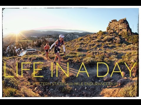
The Western States Endurance Run is the world's oldest 100-mile trail race, following the historic Western States Trail from Olympic Valley to Auburn, California. Originally a horse race, it became a foot race in 1974 when Gordy Ainsleigh completed the course on foot in 23 hours and 42 minutes.
The course traverses the Sierra Nevada mountains, featuring dramatic canyons, river crossings, and a cumulative elevation change of over 40,000 feet. The race's prestige has made it one of the most coveted entries in ultrarunning.
Experienced ultrarunners
Olympic Valley, CA, United StatesJune 26, 2027
Western States Endurance Run is a point-to-point trail race in Olympic Valley, CA, United States, held on June 26, 2027. The course covers 100.2 miles, climbs 18,000 ft, and has a 30h cutoff.

Tickets accumulate (double) each year you enter without being selected.
Total tickets = 2(n-1) where n is the number of years entered.
Must complete an approved qualifier event within the qualification window
Qualifying window: November 03, 2025 – November 08, 2026
Moderate trail conditions with some technical sections
| Location | Mile | Elevation | Cutoff | Crew | Pacers | Drop bags |
|---|---|---|---|---|---|---|
Olympic Valley Start | 0.0 | 6,230 ft | — | Crew | ||
Lyon Ridge Aid Station | 10.9 | 7,005 ft | — | |||
Red Star Ridge Aid Station | 16.5 | 7,139 ft | 5h30m10:30 AM | Drop Bags | ||
Duncan Canyon Aid Station | 24.9 | 5,741 ft | 7h30m12:30 PM | Crew | ||
Robinson Flat Aid Station | 30.8 | 6,716 ft | 9h10m2:10 PM | Crew | Drop Bags | |
Miller's Defeat Aid Station | 34.4 | 6,086 ft | 10h15m3:15 PM | |||
Dusty Corners Aid Station | 38.7 | 5,135 ft | 11h5m4:05 PM | Crew | ||
Last Chance Aid Station | 43.3 | 4,528 ft | 12h25m5:25 PM | Drop Bags | ||
Devils Thumb Aid Station | 47.8 | 4,370 ft | 14h10m7:10 PM | Drop Bags | ||
El Dorado Creek Aid Station | 53.4 | 1,788 ft | 15h40m8:40 PM | |||
Michigan Bluff Aid Station | 56.3 | 3,471 ft | 16h55m9:55 PM | Crew | Pacers | Drop Bags |
Foresthill Aid Station | 62.0 | 3,271 ft | 18h45m11:45 PM | Crew | Pacers | Drop Bags |
Dardanelles (Cal-1) Aid Station | 65.9 | 1,886 ft | 21h40m2:40 AM +1 | |||
Peachstone (Cal-2) Aid Station | 70.8 | 1,722 ft | 21h40m2:40 AM +1 | |||
Fords Bar (Cal-3) Aid Station | 73.6 | 971 ft | 24h5:00 AM +1 | |||
Rucky Chucky Aid Station | 78.2 | 735 ft | 24h5:00 AM +1 | Crew | Pacers | Drop Bags |
Green Gate Aid Station | 80.0 | 1,427 ft | 24h50m5:50 AM +1 | CrewHike in | Pacers | |
Auburn Lake Trails Aid Station | 85.3 | 1,450 ft | 26h15m7:15 AM +1 | Drop Bags | ||
Quarry Rd Aid Station | 90.7 | 768 ft | 27h40m8:40 AM +1 | |||
Pointed Rocks Aid Station | 94.7 | 1,572 ft | 28h40m9:40 AM +1 | CrewHike in | Pacers | Drop Bags |
Robie Point Aid Station | 98.9 | 1,181 ft | — | CrewHike in | Pacers | |
Placer High School Finish | 100.2 | 1,296 ft | 30h11:00 AM +1 | Crew | Drop Bags |
Sign in for race-day weather at every station, points of interest, segment-by-segment analysis, pacing, and to save this race to your calendar.
Western States is notorious for extreme heat in the canyons. Proper heat training is essential.
Canyon temperatures regularly exceed 100°F. Plan 2-4 weeks of heat acclimation training. Many runners use saunas or hot yoga to prepare.

No reviews for this event yet. Be the first to share your experience!
