Trailrace logo
Find your race Find a Qualifier
Search Dashboard Saved Races Calendar
Trailrace logo

Helping the trail running community discover, plan for, and thrive at the world's best trail races.

Feedback

  • Send Feedback
  • Feature Requests
  • Report a Bug

Company

  • About
  • Roadmap

Legal

  • Terms of service
  • Privacy policy

© 2026 Trailrace.co. All rights reserved.

Built on bad decisions in Boulder, CO.

Sandnes Ultra Trail 50 Miles

Basic Listing
  1. 2026 Edition

Point-to-point from the Sandnes Alps to the fjord, 80 km of pure Norwegian mountain

Directions
This event took place on April 18, 2026
All trail races in Norway→
April 18, 2026
Saturday 8:00am GMT+2 start
Sandnes, Rogaland
Norway
80.5 km
Point to Point Course
3,913 m
Elevation Gain
Open Registration
No lottery
No Service Requirement
Does not require trail or volunteer work
No Qualifier
No qualifier race required
Very Challenging
Experienced ultrarunners
Links
WebsiteInstagramFacebook
2021
Established
83%
Finish Rate

What Makes It Great

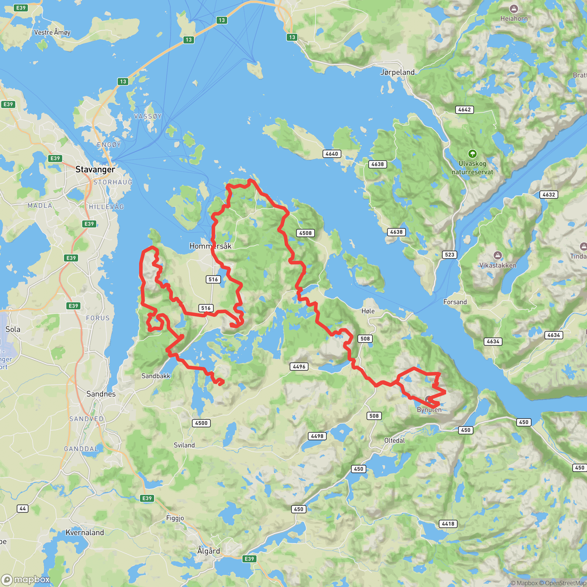
The SUT 50 Miles is an 80.5 km point-to-point from the high parking area at Bynuten to Alsvik Nature Center on the fjord. Starting from the same elevated terrain as the 100-mile course, the route traverses remote ridgelines, visits the spectacular exposed needle of Selvikstakken with its panoramic fjord views, crosses boggy Highland plateaus, and descends through fjord-side forest to the finish. A mandatory gear list applies, and GPS navigation skills are strongly recommended.

Difficulty

Advanced
7/10

Experienced ultrarunners

Technical Terrain
Steep Climbing
Technical Descent
Night Running
Variable Weather
No Pacers

Sandnes Ultra Trail 50 Miles

Sandnes, Rogaland, NorwayApril 18, 2026

April 18, 2026
Course map for Sandnes Ultra Trail 50 Miles
DistDistance80.5 km
GainElevation Gain3,913 m
LimitCutoff29 h
Steep ClimbingTechnical DescentNight RunningVariable WeatherNo Pacers

Entry Timeline

Race DayApril 18, 2026

Lottery

This event uses open registration - no lottery entry required.

Qualifier

This event does not require a qualifier for entry.

Service Requirement

This race does not have a service requirement for entry.
80.5 km
Distance
Point to Point
Route
29h
Cutoff Time
212 m
Average Elevation
3,913 m
Total Ascent
4,289 m
Total Descent
670 m
High Point
3 m
Low Point
Course map
Launch Course Explorer

Aid Stations

LocationkmElevation
Start
Start
0.0436 m
Parking Bynuten
Aid Station
15.0259 m
Dansenveien
Resource
23.049 m
Breivik
Aid Station
33.029 m
Frøylandsvatnet
Resource
46.0126 m
Hogstad
Aid Station
54.0106 m
Dale
Aid Station
66.032 m
Gramstad
Resource
72.0242 m
Finish
Finish
80.557 m

Sign in to see cutoffs, crew access, drop bags, and services for every aid station.

On-Site Camping Available

Tent camping and open-shelter (gapahuk) available at Alsvik Nature Center start/finish. No advance reservation needed. Access to kitchen, common room, changing rooms, and showers. Nearby partner hotel: Kronen Gaard Hotell, 6 km from Alsvik (~895 NOK single / 1095 NOK double incl. breakfast — mention SUT registration).

Crew Access Points

Pacer Rules

No Pacers Allowed

Crew Rules

  • Crew permitted at designated aid stations only.

Gear Rules

Trekking poles allowed

Required Gear

No required gear specified

Recommended Gear

No recommended gear specified

Videos & Race Reports

No videos or race reports available for this event yet.

Reviews

to write a review.

No reviews for this event yet. Be the first to share your experience!

Register•April 18, 2026