Self-navigating point-to-point through the Norwegian landscape, Oslo to the sea
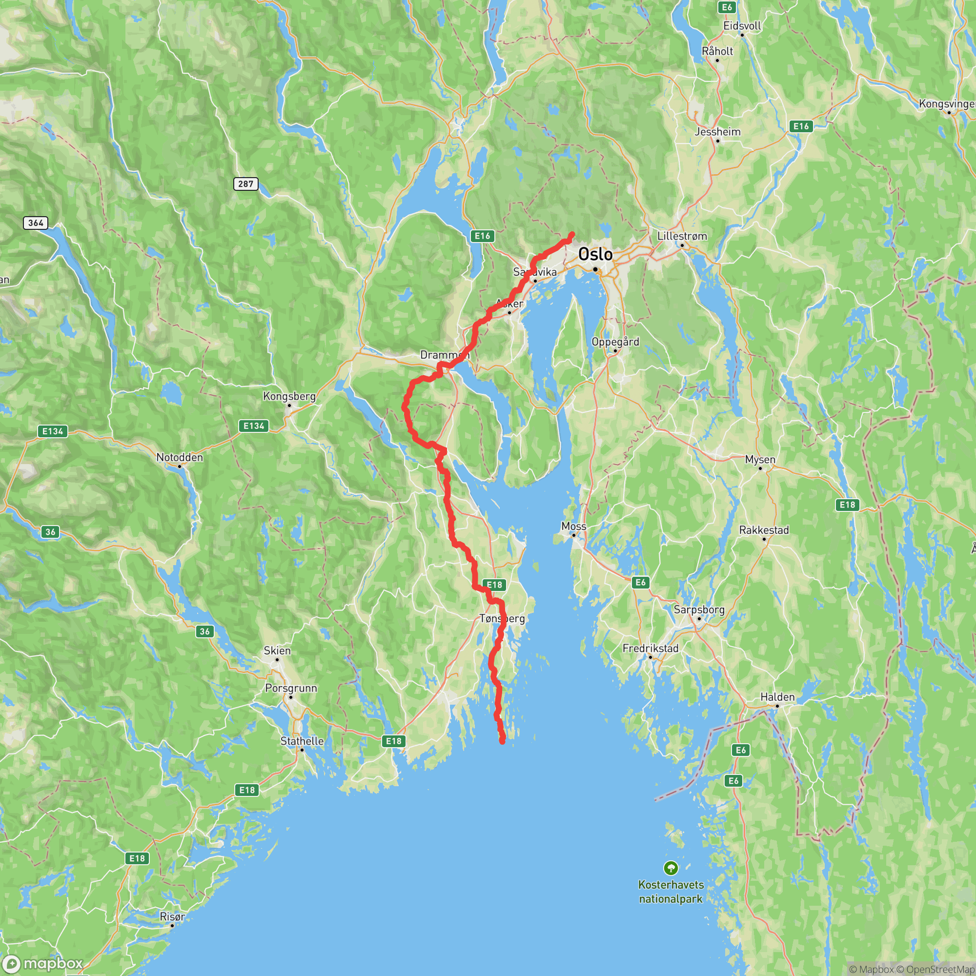
A point-to-point ultra covering approximately 165 kilometers from Soria Moria Hotel in the hills above Oslo to the coastal tip of Tjøme island in Vestfold, where the archipelago meets the open sea. Roughly three-quarters of the course is on soft ground — footpath, dirt road, and gravel — as runners pass through forests, farmland, and the fjord-flanked landscape of the Oslo region. The course is entirely unmarked; each runner navigates independently using a GPS track or paper map. Four staffed service stations at Drammen, Sande, Hengsrød, and Teie provide food and drink, while the race's self-support ethos means runners carry what they need between them. Finishing at Verdens Ende — literally 'World's End' — is one of Scandinavia's most evocative race finishes.
Experienced ultrarunners
Oslo, Oslo, NorwayMay 30, 2026
| Location | km | Elevation |
|---|---|---|
Start – Soria Moria Start | 0.0 | 483 m |
CP1 – Drammen Aid Station | 48.1 | 2 m |
CP2 – Sande Aid Station | 83.1 | 13 m |
CP3 – Hengsrød Aid Station | 117.4 | 88 m |
CP4 – Teie Aid Station | 141.7 | 70 m |
Vrengen bro Aid Station | 153.1 | 40 m |
Finish – Verdens Ende Finish | 165.0 | 17 m |
Sign in to see cutoffs, crew access, drop bags, and services for every aid station.
Late May nights in Norway can be cold, especially in forested inland sections. Runners must carry mandatory windproof and leg coverage gear.
Norwegian spring weather is unpredictable; rain and low temperatures are common and runners must be self-sufficient between aid stations.
No required gear specified
No recommended gear specified
No videos or race reports available for this event yet.
No reviews for this event yet. Be the first to share your experience!