Trailrace logo
Find your race Upcoming Find a Qualifier
Search Dashboard Saved Races Calendar
Trailrace logo

Helping the trail running community discover, plan for, and thrive at the world's best trail races.

Find Races

  • Search all trail races
  • Explore collections
  • Race series
  • Race qualifiers

Races by Location

  • Colorado trail races
  • California trail races
  • Utah trail races
  • Arizona trail races
  • Washington trail races
  • All US trail races

Lottery Odds

  • Western States 100
  • Hardrock 100
  • High Lonesome 100
  • UTMB
  • All calculators

Company

  • About
  • Roadmap
  • Terms of service
  • Privacy policy

Feedback

  • Send Feedback
  • Feature Requests
  • Report a Bug

© 2026 Trailrace.co. All rights reserved.

Built on bad decisions in Boulder, CO.

The Brink 100

Basic Listing
  1. Siskiyou Out Back
  2. 2026 Edition

A town-to-summit sufferfest through the remote Siskiyou backcountry — downtown Ashland to alpine finish

Directions
DeadlineJuly 06, 2026
This event took place on July 10, 2026

Nearby races

Other trail races within 195 miles

Siskiyou Out Back 100K

Siskiyou Out Back 100K

100K
Ashland, OR, US
Jul 11, 2026
60.4 miles
10,500 ft gain
Loop
Dropbags
Rogue Gorge 12K

Rogue Gorge 12K

10K
Union Creek, OR, US
Oct 18, 2026
7.52 miles
330 ft gain
Loop
59 mi away
Bachelor Ascent 16K

Bachelor Ascent 16K

10M
Bend, OR, US
Sep 12, 2026
10.2 miles
2,750 ft gain
Loop
Crew
144 mi away
Oregon Cascades 100 Mile
Service Req

Oregon Cascades 100 Mile

100 Mile
Bend, OR, US
Jul 25, 2026
100.04 miles
10,900 ft gain
Point to Point
Crew
Pacers
Dropbags
153 mi away
Perpetua Coast Half Marathon

Perpetua Coast Half Marathon

Half Marathon
Yachats, OR, US
Oct 4, 2026
13.3 miles
2,660 ft gain
Point to Point
Crew
170 mi away
McDonald Forest 50K Trail Run

McDonald Forest 50K Trail Run

50K
Corvallis, OR, US
May 2, 2026
31.75 miles
8,060 ft gain
Loop
Crew
Dropbags
181 mi away
Mountain Lakes 100
Service Req

Mountain Lakes 100

100 Mile
Olallie Lake, OR, US
Sep 19, 2026
100.97 miles
11,700 ft gain
Out and Back
Crew
Pacers
Dropbags
195 mi away
All trail races in Oregon→
July 10, 2026
Friday 4:20pm PDT start
Ashland, OR
United States
100.1 miles
Point to Point Course
22,800 ft
Elevation Gain
Historical weather
49°F / 76°FLo/Hi Temp
45°F / 75°FFeels Like
9%Cloud Cover
0% (0.00 in)Precipitation
10 mphWind Speed
44%Humidity
5:45 AMSunrise
8:46 PMSunset
Open Registration
No lottery
No Service Requirement
Does not require trail or volunteer work
No Qualifier
No qualifier race required
Very Challenging
Experienced ultrarunners
Links
WebsiteInstagramFacebook
1999
Established
100
Field Size

What Makes It Great

The inaugural Brink 100 is a point-to-point mountain hundred that begins in the heart of downtown Ashland and climbs more than 23,000 feet to a summit finish at Mt. Ashland Lodge. Launched as part of the SOB festival in 2026, it sends runners through the Ashland Creek Watershed on a dramatic overnight journey featuring two full 5,000-foot ascents, three peaks above 7,000 feet — Wagner Butte, Dutchman Peak, and Mt. Ashland — remote singletrack on the 7 Mile Ridge Trail, the Applegate River Watershed, and the historic Sterling Ditch Trail before joining the PCT for the final push to the summit. Runners pick up pacers near the halfway point before the second brutal climb.

Difficulty

Advanced
8/10

Experienced ultrarunners

Steep Climbing
Technical Terrain
Night Running
Remote Terrain
Exposed Ridgeline
Variable Weather

Race Highlights

Town to summit — 23,000 ft of climbing
Starts under city lights in downtown Ashland and climbs over 23,000 feet to finish high at Mt. Ashland Lodge
Three 7,000-foot peaks
Summits Wagner Butte, Dutchman Peak, and Mt. Ashland across 100 miles of remote Siskiyou terrain
Two monster overnight climbs
Runners tackle two separate 5,000-foot ascents, the second beginning deep in remote backcountry as the sun rises
Buckle and ACG travel bag
Finishers earn a Brink 100 buckle and an embroidered Nike ACG bag — distinctive hardware for an inaugural race

Finish Awards

Finisher Buckle + ACG Travel Bag
All finishers receive a Brink 100 belt buckle and an embroidered Nike ACG travel bag.
Overall Winner Awards
Special awards to the overall male and female winners.

The Brink 100

Ashland, OR, United StatesJuly 10, 2026

July 10, 2026
Course map for The Brink 100
DistDistance100.1 mi
GainElevation Gain22,800 ft
LimitCutoff31.6666666666666666 h
Steep ClimbingNight RunningRemote TerrainExposed RidgelineVariable Weather

Entry Timeline

Registration DeadlineJuly 06, 2026
Race DayJuly 10, 2026

Lottery

This event uses open registration - no lottery entry required.

Qualifier

This event does not require a qualifier for entry.

Service Requirement

This race does not have a service requirement for entry.
100.1 mi
Distance
Point to Point
Route
31h40m
Cutoff Time
4,472 ft
Average Elevation
22,800 ft
Total Ascent
20,750 ft
Total Descent
7,470 ft
High Point
1,896 ft
Low Point
Course map
Launch Course Explorer

Aid Stations

LocationMileElevation
Start
Start
0.01,900 ft
Bottom Ricketty
Aid Station
5.23,707 ft
Bottom Wagner Glade
Aid Station
11.04,921 ft
Bottom Wagner Butte
Aid Station
19.64,984 ft
Caldera
Aid Station
25.63,422 ft
Bottom Bald Mtn Rd
Aid Station
29.63,570 ft
JackAsh Top
Aid Station
36.64,741 ft
Sterling Mine Start
Aid Station
42.83,196 ft
Armstrong Gulch Road
Aid Station
50.52,618 ft
Wolf Gap Trail
Aid Station
58.43,593 ft
Bear Gulch
Aid Station
67.02,526 ft
Glade Creek
Aid Station
71.33,563 ft
Wrangle Springs
Aid Station
77.76,253 ft
Jackson Gap 1
Aid Station
82.07,018 ft
Jackson Gap 2
Aid Station
84.77,018 ft
Siskiyou Gap
Aid Station
90.95,837 ft
Willammette
Aid Station
95.06,932 ft
Grouse Gap Water
Aid Station
96.96,624 ft
Finish
Finish
100.16,572 ft

Sign in to see cutoffs, crew access, drop bags, and services for every aid station.

On-Site Camping Available

Paved camping at Mt. Ashland Lodge parking lot available Friday and Saturday nights. New in 2026: limitations on where you can park. No reservations mentioned — first come, first served.

Crew Access Points

Pacer Rules

  • Pacers may be picked up at the Sterling Mine Start aid station (approximately mile 43), at the end of the Sterling Ditch section and before the second 5,000-foot climb.

Crew Rules

  • Crew access is available at Bottom Wagner Butte (~mile 20), Bottom Bald Mountain (~mile 30), Sterling Mine Start (~mile 43), Bear Gulch (~mile 67), Wrangle Springs (~mile 78), and the finish at Mt. Ashland Lodge.
Daylight
15h 1m
5:45 AM8:46 PM
76°F / 49°F
Feels like 75°F / 45°F
Temperature Hi/Lo
0% (0.00 in)
Precipitation
10 mph
Wind
44%
Humidity
9%
Cloud Cover
Based on historical averages for July 12
Cold/Hypothermia Risk

Overnight temperatures at elevation drop significantly; runners are out through the night from 4:20 PM start

Rapid Weather Changes

Course passes through multiple microclimates from valley floor to exposed alpine ridgeline

Gear Rules

No trekking poles

Required Gear

No required gear specified

Recommended Gear

No recommended gear specified

Videos from other Siskiyou Out Back Trail Running Festival events

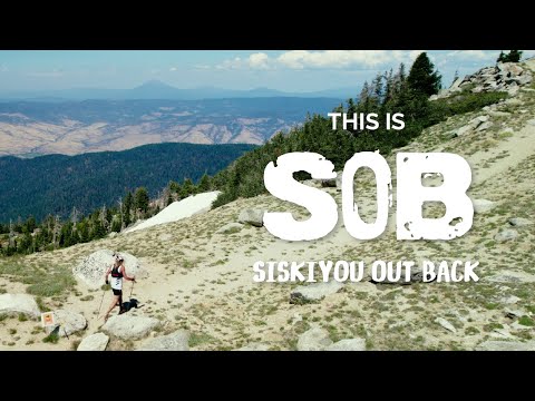
This is Siskiyou Out Back
Siskiyou Out Back 100K
Hal Koerner•2023
Running the Siskiyou Out Back Festival 50k Race (31 miles)
Siskiyou Out Back 50K
Triple T•2023
My story from the 2024 Siskiyou Out Back (SOB) 100 km Trail Run
Siskiyou Out Back 100K
Desert Shepherds•2024

Race reports from other Siskiyou Out Back Trail Running Festival events

Siskiyou Out Back 100K Race ReportSiskiyou Out Back 100K
By NW Dirt Churners • 2023

Reviews

to write a review.

No reviews for this event yet. Be the first to share your experience!

Register•July 10, 2026