Manning Park's finest trails — 14,000 ft of gain in 100K
Other trail races within 136 miles


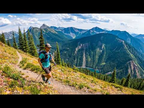
The Fat Dog 100K follows the second half of the 120-mile course, starting at the Cascade Rest Area on Highway 3 west of Manning Park and finishing at Lightning Lake. The route traverses the rolling Skagit Bluffs singletrack, climbs to Grainger Creek and on through the spectacular Heather Trail atop Blackwall Peak, then crests the Skyline trail for panoramic false summits before dropping to the finish. With 14,000 feet of gain across remote backcountry trails, it earns 3 UTMB Index points and qualifies for Western States with a sub-22-hour finish.
Experienced ultrarunners
Keremeos, BC, CanadaAugust 08, 2026
Fat Dog 100K is a point-to-point trail race in Keremeos, BC, Canada, held on August 08, 2026. The course covers 100 km, climbs 4,267 m, and has a 26h cutoff.

Same trail work/volunteer requirement as all other distances. Proof due July 15.
Submission deadline: July 15, 2026
| Location | km | Elevation | Cutoff | Crew | Pacers | Drop bags |
|---|---|---|---|---|---|---|
Fat Dog 100K Start Line Start | 0.0 | 776 m | — | |||
Cayuse Flats Aid Station Aid Station | 5.7 | 807 m | — | |||
Grainger Creek Aid Station Aid Station | 12.7 | 953 m | — | |||
Hope Pass Aid Station Aid Station | 28.4 | 1,655 m | 7h3:00 PM | Crew | Drop Bags | |
Nicomen Lake Aid Station Aid Station | 40.8 | 1,791 m | — | |||
Heather Aid Station Aid Station | 56.2 | 2,047 m | — | |||
Blackwall Peak Aid Station Aid Station | 67.0 | 1,796 m | — | Crew | Pacers | Drop Bags |
Windy Joe's Aid Station Aid Station | 77.7 | 1,192 m | 20h4:00 AM +1 | Crew | Pacers | |
Strawberry Flats Aid Station Aid Station | 85.7 | 1,370 m | 22h6:00 AM +1 | Crew | Pacers | Drop Bags |
Finish Line Finish | 103.3 | 1,244 m | 26h10:00 AM +1 | Crew | Drop Bags |
Sign in for race-day weather at every station, points of interest, segment-by-segment analysis, pacing, and to save this race to your calendar.
Camping available in Manning Provincial Park campgrounds and along Ashnola River Road near the 120M start. No overnight vehicle parking at aid stations or along roadways. Trail work days include first-come, first-served camping at Manning Park or along Ashnola River Road.
No required gear specified
No recommended gear specified
No reviews for this event yet. Be the first to share your experience!
