241 miles through canyon country, alpine peaks, and desert extremes
Moab 240 Endurance Run takes place on October 09, 2026 in Moab, UT.
Moab 240 Endurance Run is 241.8 miles with 31,890 ft of elevation gain.
Yes — entry to Moab 240 Endurance Run is decided by lottery.
Yes, crew is allowed at Moab 240 Endurance Run. Crew can access 8 of the 19 locations listed on this page.
Yes, pacers are allowed at Moab 240 Endurance Run. Pacers can be picked up at 6 of the 19 locations listed on this page.
Yes, Moab 240 Endurance Run allows drop bags. Drop bags are accepted at 14 of the 19 locations listed on this page.
Moab 240 Endurance Run has 16 aid stations along the course.
The overall cutoff for Moab 240 Endurance Run is 112h. Individual cutoffs for 16 of the 19 locations listed on this page are published below.
Moab 240 Endurance Run has published cutoff times at 16 points on the course. Each one is listed on this page with its location, distance and cutoff.
Other trail races within 119 miles


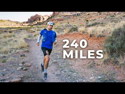
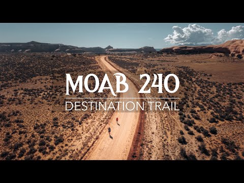
The Moab 240 traces a 241.8-mile single loop through some of Utah's most spectacular terrain, starting and finishing in Moab. Runners travel alongside the Colorado River through Lockhart Basin before climbing into the remote Abajo Mountains, then up through the high-altitude La Sal Mountains, returning through canyon country flanked by Canyonlands and Arches National Parks. The course spans extremes from scorching desert flats at 4,000 feet to alpine ridgelines above 11,000 feet, with 15 fully stocked aid stations including five dedicated sleep stations. Created in 2017 in memory of ultrarunner Stephen Jones, it is part of Destination Trail's Triple Crown of 200s and a Western States 100 qualifying race.
Experienced ultrarunners
Moab, UT, United StatesOctober 09, 2026
Moab 240 Endurance Run is a loop trail race in Moab, UT, United States, held on October 09, 2026. The course covers 241.8 miles, climbs 31,890 ft, and has a 112h cutoff.

Two-week lottery registration window in early January. Credit card required at registration; charged only if selected. Runners with transfer credits from prior years bypass the lottery. Waitlist opens one week after the lottery draw.
Moderate trail conditions with some technical sections
| Location | Mile | Elevation | Cutoff | Crew | Pacers | Drop bags |
|---|---|---|---|---|---|---|
Start Start | 0.0 | 3,967 ft | 6:00 AM | Crew | Drop Bags | |
Hidden Valley Aid Station | 8.3 | 4,587 ft | — | |||
Amasa Back Aid Station | 16.8 | 3,999 ft | 7h1:00 PM | Crew | Drop Bags | |
Base Camp Aid Station | 29.1 | 3,986 ft | 12h30m6:30 PM | |||
Lockhart H2O Aid Station | 33.5 | 4,055 ft | — | |||
The Oasis Aid Station | 53.5 | 4,472 ft | 22h30m4:30 AM +1 | |||
Indian Creek Aid Station | 67.8 | 4,701 ft | 28h30m10:30 AM +1 | Pacers | Drop Bags | |
The Island Aid Station | 81.6 | 5,315 ft | 34h30m4:30 PM +1 | Drop Bags | ||
Bridger Jack Aid Station | 96.5 | 6,663 ft | 41h59m11:59 PM +1 | Drop Bags | ||
Shay Mountain Aid Station | 114.2 | 8,317 ft | 51h9:00 AM +2 | Crew | Pacers | Drop Bags |
Monticello Lake Aid Station | 126.4 | 8,619 ft | 57h3:00 PM +2 | Crew | Pacers | Drop Bags |
Dry Valley Aid Station | 143.8 | 6,289 ft | 64h30m10:30 PM +2 | Crew | Pacers | Drop Bags |
The Needles Aid Station | 157.7 | 6,086 ft | 71h5:00 AM +3 | Drop Bags | ||
Road 46 Aid Station | 171.1 | 6,060 ft | 76h30m10:30 AM +3 | Crew | Pacers | Drop Bags |
Pole Canyon Aid Station | 188.4 | 8,117 ft | 84h30m6:30 PM +3 | Drop Bags | ||
Geyser Pass Aid Station | 202.7 | 8,973 ft | 93h30m3:30 AM +4 | Crew | Pacers | Drop Bags |
Waypoint 19 Landmark | 202.5 | 9,603 ft | — | |||
Porcupine Rim Aid Station | 223.6 | 7,274 ft | 103h30m1:30 PM +4 | Drop Bags | ||
Finish Finish | 241.5 | 3,970 ft | 112h10:00 PM +4 | Crew | Drop Bags |
Sign in for race-day weather at every station, points of interest, segment-by-segment analysis, pacing, and to save this race to your calendar.
Start/finish at Sun Outdoors Arches Gateway RV Resort (1773 N HWY 191). The venue is a full campground. Additional overnight parking available at AArchway Inn nearby.
Held in early October, the Moab 240 spans dramatically different climate zones. Desert sections near Moab and Lockhart Basin (4,000–5,500 ft) are typically warm and sunny during the day (60–85°F) with cool nights (35–50°F). The Abajo Mountains (8,000–9,000 ft) bring cooler temperatures and possible rain. The La Sal Mountains (up to 11,500+ ft) are the most unpredictable — snow and freezing temperatures are possible in October, and race history includes lows of 7°F and highs of 95°F. Runners must be prepared for full winter conditions in the mountains and desert heat in the canyons, sometimes within hours of each other.
No recommended gear specified
No reviews for this event yet. Be the first to share your experience!
