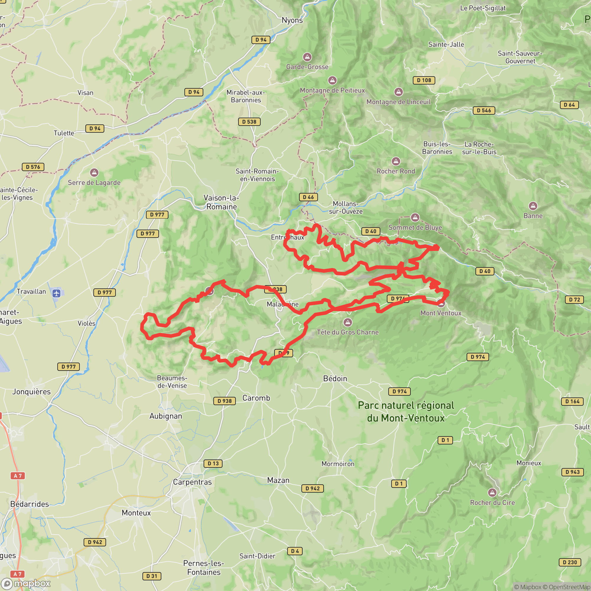
A 87 km loop over the northern face of Mont Ventoux — classic Provençal ultra terrain
Other trail races within 187 miles
The Grande Epopée Ventoux covers 87 km with 4,200 m of climbing through the northern flanks of Mont Ventoux and the Dentelles de Montmirail. Starting in Malaucène at dawn, runners pass through Entrechaux, the iconic forest road to Mont Serein, and loop back through the Plan de Laval before a final push to the Malaucène finish. A demanding mid-distance UTMB World Series event suited to experienced ultrarunners.
Some ultra experience recommended
Malaucène, FranceApril 25, 2026
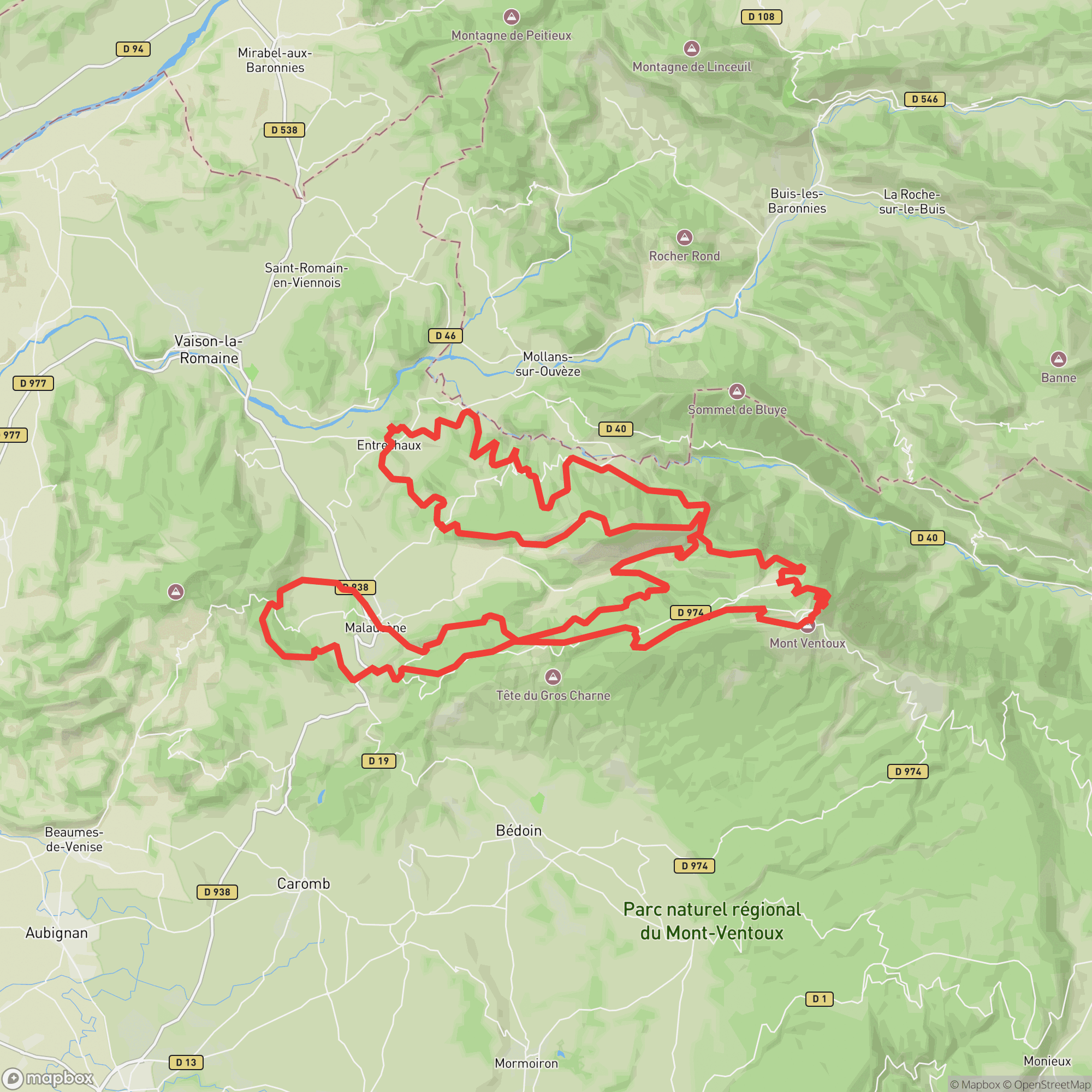
| Location | km | Elevation |
|---|---|---|
Malaucène Start | 0.0 | 310 m |
La Gavoite Landmark | 5.4 | 630 m |
Le Sueil Landmark | 6.4 | 720 m |
Bout du monde Aid Station | 14.9 | 593 m |
Col du Comte Landmark | 17.9 | 974 m |
Pic du Comte Landmark | 19.1 | 1,135 m |
Combe Arnoux Landmark | 24.2 | 531 m |
Entrechaux Aid Station | 34.3 | 281 m |
Veaux Aid Station | 46.8 | 335 m |
Col du Comte Landmark | 51.6 | 974 m |
Mont Serein Aid Station | 56.8 | 1,402 m |
Mont Ventoux Landmark | 61.8 | 1,877 m |
Les Prés de Michel Landmark | 68.9 | 1,112 m |
Rochers des Rams Landmark | 71.0 | 924 m |
Le Sueil Aid Station | 72.4 | 720 m |
Chapelle Piaud Landmark | 74.6 | 689 m |
Portail Saint Jean Landmark | 76.1 | 455 m |
Oratoire St Michel Landmark | 78.3 | 397 m |
Plan de Laval Aid Station | 79.7 | 355 m |
Col de la Chaîne Landmark | 83.3 | 465 m |
Malaucène Finish | 87.4 | 310 m |
Sign in to see cutoffs, crew access, drop bags, and services for every aid station.
No required gear specified
No recommended gear specified
No videos or race reports available for this event yet.
No reviews for this event yet. Be the first to share your experience!