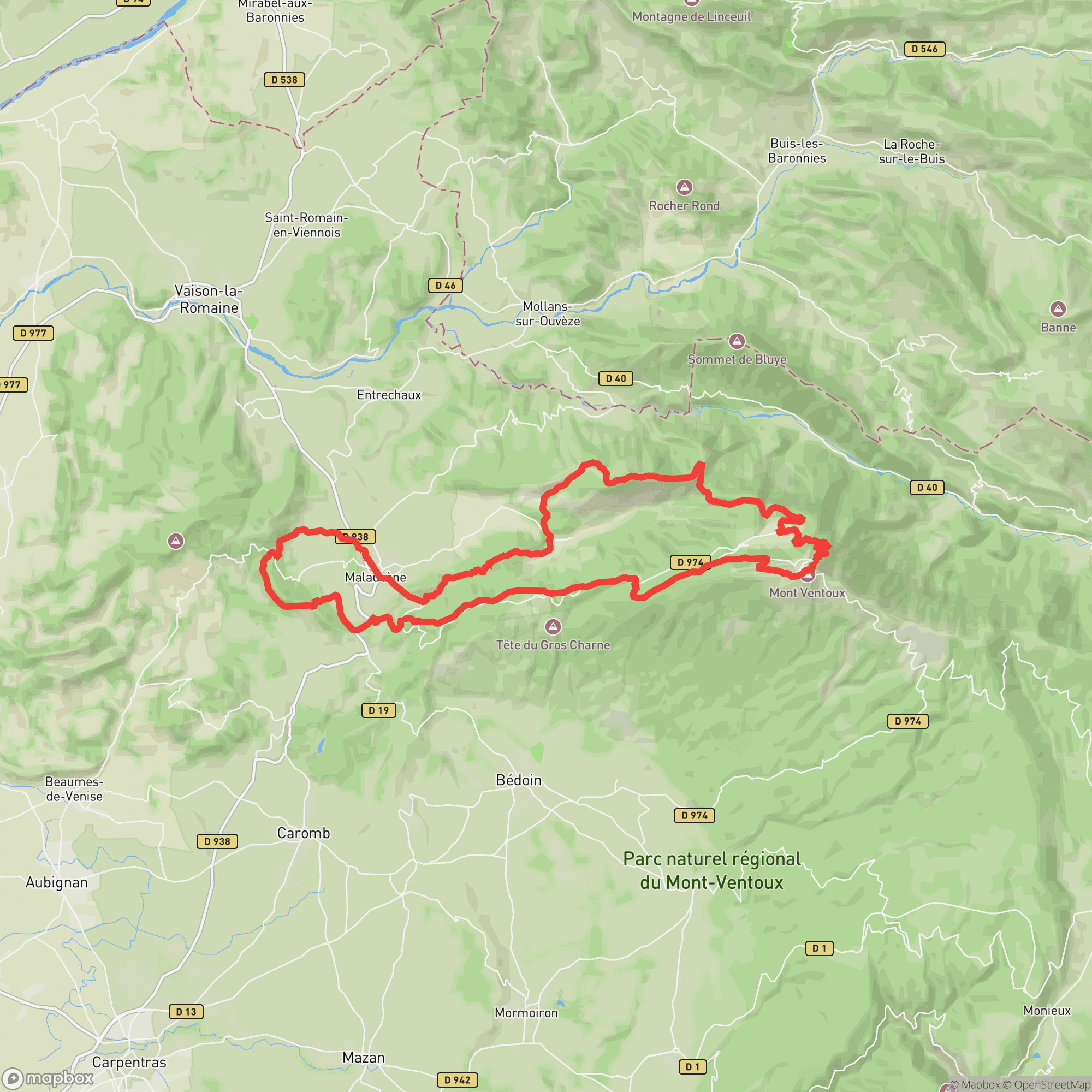
A 51 km Sunday morning traverse of the southern Ventoux slopes in the heart of Provence
Other trail races within 187 miles
The Mistral Marathon Trail offers 51.5 km of trail running on the southern approaches to Mont Ventoux, with 2,500 m of cumulative gain. Starting Sunday morning in Malaucène, the course climbs to the Mont Serein ski station before descending through Plan de Laval back to the village. A challenging but approachable distance that draws competitive trail runners and seasoned ultra veterans alike.
Some ultra experience recommended
Malaucène, FranceApril 26, 2026
| Location | km | Elevation |
|---|---|---|
Malaucène Start | 0.0 | 310 m |
La Gavoite Landmark | 5.4 | 628 m |
Saint-Marguerite Aid Station | 7.9 | 471 m |
Combe Arnoux Landmark | 9.4 | 503 m |
Col du Comte Landmark | 15.8 | 996 m |
Mont Serein Aid Station | 20.9 | 1,398 m |
Mont Ventoux Landmark | 26.0 | 1,882 m |
Les Près de Michel Landmark | 33.0 | 1,129 m |
Le Sueil Aid Station | 36.5 | 735 m |
Chapelle Piaud Landmark | 38.5 | 703 m |
Portail Saint Jean Landmark | 40.2 | 449 m |
Oratoire St Michel Landmark | 42.4 | 402 m |
Plan de Laval Aid Station | 43.8 | 345 m |
Col de la Chaîne Landmark | 47.4 | 470 m |
Malaucène Finish | 51.5 | 310 m |
Sign in to see cutoffs, crew access, drop bags, and services for every aid station.
No required gear specified
No recommended gear specified
No videos or race reports available for this event yet.
No reviews for this event yet. Be the first to share your experience!